


Turkey's Earthquake: Check which parts of India are in top seismic zone
By Lokmat English Desk | Published: February 7, 2023 08:16 PM2023-02-07T20:16:55+5:302023-02-07T20:16:55+5:30

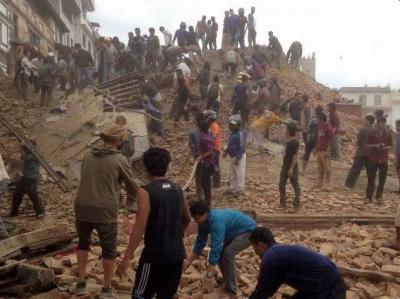
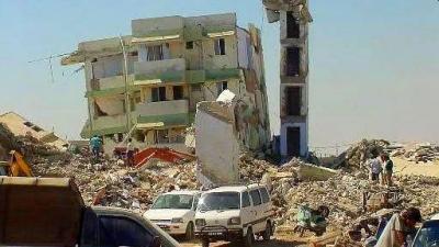
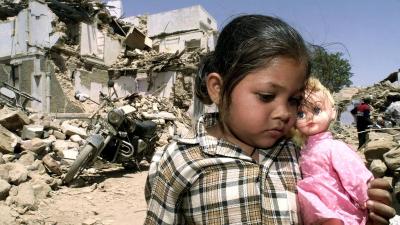
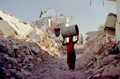
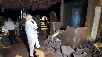
The world has been shaken by the devastating earthquakes in Turkey and Syria. Nearly 5,000 people have died, and buildings have been seen collapsing like cards. Looking at this earthquake, Prime Minister Narendra Modi was reminded of the earthquake in Gujarat. Turkey has been shaken more than 550 times, not two or four, in the last two days. What if a similar earthquake occurs in India? There is a possibility of destruction that will not even be thought of.
At least 1000 earthquake shocks are felt in India every year. In this too, the ground shakes two hundred to two hundred and fifty times. Other earthquakes are of low intensity. As they are felt in Turkey. What is shocking is that 59 per cent of the country's share falls within the range of the threat of high levels of earthquakes. The highest threat is in the Himalayan region. There were so many strong earthquakes in this area that there was a very high intensity on the Richter scale.

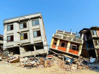
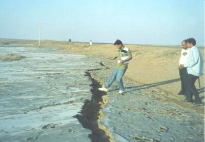
In 1897, an earthquake measuring 8.1 on the Richter scale struck the Shillong Plateau. There was an earthquake of 7.8 Richter scale in Kangra in 1905, an earthquake of 8.3 Richter scale on the Bihar-Nepal border in 1934, an earthquake of 8.5 Richter scale on the Arunachal-China border in 1950, and then an earthquake of 7.9 Richter scale in Nepal in 22. The two continental tectonic plates are found near these areas. This causes moderate-to-dangerous-level earthquakes in these areas.
The Indian tectonic plate and the Tibetan plate collide with each other. This creates pressure. This causes an earthquake. The entire 2400-km area is at the highest risk. The Bureau of Indian Standards (BIS) has divided the country into five different earthquake zones.
The fifth zone is considered to be the most dangerous and active in the country. States and areas falling in this zone are most prone to destruction. Let's see which areas and zones are there...
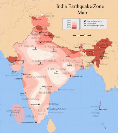
The fifth zone accounts for 11% of the entire country's land area. The fourth zone has 18% of the land area, and the third-second zone has 30%. States in Zones 4 and 5 are most at risk. Different areas of the same state fall into different zones. Because of this, half of the state can be in one zone and the other half in another zone.
Earthquake Zone 1
There is no threat to the areas falling in this zone. The parts that are shown in white in the photo above fall in this zone.
Earthquake Zone 2
Parts of Rajasthan, Haryana, Madhya Pradesh, Maharashtra, Odisha, Andhra Pradesh, Telangana and Tamil Nadu fall under Earthquake Zone-2. This zone is less seismic.
Earthquake Zone 3
Kerala, Goa, Lakshadweep group, parts of Uttar Pradesh and Haryana, parts of Gujarat and Punjab, parts of West Bengal, parts of West Rajasthan, Madhya Pradesh, parts of Bihar, the northern part of Jharkhand and parts of Chhattisgarh fall. Parts of Maharashtra, Odisha, Andhra Pradesh, Telangana, Tamil Nadu and Karnataka are also in this zone.
Earthquake Zone 4
Parts of Jammu and Kashmir, Ladakh, and parts of Himachal and Uttarakhand fall in the fourth zone. Apart from this, Haryana, Punjab, Delhi, Sikkim, the northern part of Uttar Pradesh, a small part of Bihar and West Bengal, Gujarat, parts of Maharashtra near the west coast, and a small part of west Rajasthan fall in this zone.

The most dangerous zone
Zone 5 is the most dangerous. In this zone, parts of Jammu and Kashmir (Kashmir Valley), the western part of Himachal, the eastern part of Uttarakhand, Kutch of Gujarat, part of North Bihar, all the north-eastern states of India, and the Andaman and Nicobar Islands.
 - News | Prajwal Revanna Sex Scandal: JDS MP Raped 400 Women, Alleges Rahul Gandhi Seeks Apology From PM Modi (Watch Video) | Latest national News at Lokmattimes.com")
 - News | Congress Wants To Change India’s Constitution To Give Reservation of SC, ST and OBC Communities to Muslims, Says PM Modi (Watch Video) | Latest national News at Lokmattimes.com")

 - News | Narendra Modi or Rahul Gandhi? Kolhapur BJP Leader Asks Public Who They Want As PM, Gets Surprised With Response (Watch) | Latest maharashtra News at Lokmattimes.com")

